


MDA Ltd. announced at the 2022 UN Ocean Conference it’s providing the Global Fishing Watch (GFW) access to the company’s RADARSAT-2 satellite radar archive to effectively combat illegal, unreported, and unregulated (IUU) fishing activities. This archive represents 14 years of historical record of the Earth, with more than 970,000 images that include over 26 billion square kilometers of oceanic synthetic aperture radar (SAR) data.
The United Nations list IUU fishing as the planet’s sixth-largest crime, with an estimated cost of USD 23.5 billion (EUR 22.5 billion) annually. About 20 percent of the over 90 million metric tons of fish caught globally each year are captured illegally, according to the U.N.
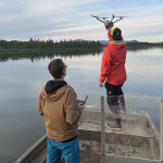
MDA is a Brampton, Ontario, Canada-based international space mission partner as well as a robotics, satellite systems, and geo-intelligence pioneer. The company has been active in the fight against IUU by providing near real-time monitoring of fishing activity to nations through its MDA Maritime Insights Platform. MDA has worked with the Canadian government as well as international fisheries agencies for years in support of maritime enforcement initiatives by providing actionable maritime-intelligence data to address dark-vessel detection.
"MDA believes in using space-based technology to make life better on Earth, and we're proud to play a leading role in helping Global Fishing Watch and nations around the world stop the unacceptable level of illegal fishing activities that take place every single day and put our ocean ecosystems and economies at serious risk," MDA CEO Mike Greenley said. "Seeing is believing, and our RADARSAT-2 satellite imagery, combined with MDA's expertise in maritime domain awareness and analytics, creates a powerful, complete, and compelling visual record backed by scientific insight of what is happening on the world's oceans."
GFW is an international non-governmental organization that is focused on advancing sustainability of our oceans through increased transparency. The new satellite archives are intended to help map IUU fishing patterns using science-based analytics. These maps can then be used by international policymakers, conservationists, and researchers to be more effective in fighting IUU.
"Global Fishing Watch is revealing human activity in the ocean and making it freely available to the world. MDA's RADARSAT-2 satellite imagery, combined with our AI and datasets, has the potential to revolutionize understanding of the marine environment by shining a light on hidden and suspicious fishing activity," GFW CEO Tony Long said. "We applaud MDA's ground-breaking contribution to ocean management and are excited to harness their imagery to help rein in the outlaw ocean and bring greater transparency to what happens at sea."
Through collaboration with MDA and strategic investments by the federal government, Canada – which has the longest coastline of any country in the world – has been able to become an early leader using space-based technology to survey and support the sustainability of the ocean ecosystems. The RADARSAT-2 can also image more then 250,000 square kilometers of the ocean in less than a minute, regardless of weather conditions or time of day. Now, with the RADARSAT-2 satellite and associated products like MDA’s Maritime Insights platform, nations around the world can better understand what is happening on their coastlines, the company said.