


Japan and Peru, two of the world’s biggest players when it comes to seafood, are hoping to crack down on illegal, unreported, and unregulated (IUU) fishing in their exclusive economic zones through increased use of cutting-edge technology.
A key player in both countries’ efforts is the Global Fishing Watch, an international nonprofit organization with the goal of “advancing sustainability of the oceans through increased transparency.” Its mapping platform, which can be found on the GFW website, allows anyone to view or download data and investigate global fishing activity in near real-time, for free. GFW was founded in 2015 through a collaboration between Oceana, SkyTruth, and Google.
Global Fishing Watch’s tracking of automatic identification system (AIS) messages from ocean-going boats is now being used to fight illegal transshipment inside and near Japan’s exclusive economic zone. GFW recently signed onto a collaboration with the Japan Fisheries Research and Education Agency (FRA) and the Australian National Centre for Ocean Resources and Security (ANCORS) at the University of Wollongong to investigate IUU fishing and strengthen transparency and governance of fisheries within the region.
To detect pairs of vessels meeting at sea, GFW and analysts at SkyTruth and Google applied machine learning algorithms to more than 30 billion automatic identification system (AIS) messages from ocean-going boats to find tell-tale transshipment behavior, such as two vessels alongside each other long enough to transfer catch, crew, or supplies. AIS is a collision avoidance system that constantly transmits a vessel’s location at sea. These transmissions are collected by satellite receivers and delivered to GFW for automated processing. Nearly all refrigerated cargo vessels carry AIS and those ships receiving fish can be identified and their activity plotted on the map.
Transshipment is not always illegal. However, it can be used to obscure the origin of seafood, according to Tony Long, the CEO of Global Fishing Watch.
“Transshipments are normally coordinated and authorized by RFMOs [regional fishery management organizations]. There is significant concern that transshipment takes place without authority,” Long said. “Transshipment often occurs out of sight and beyond the reach of any nation’s jurisdiction. It’s a weak spot in the monitoring and control of fishing activity and can provide cover for illegal fishing and other unscrupulous and criminal activity, including smuggling and human trafficking. The lack of effective monitoring and controls presents opportunities for bad actors to obscure or manipulate data on their fishing practices, the species or amounts caught, and catch locations.’
The partnership will also track the purse seine and “night light” fishing fleets in the Pacific using nighttime satellite imagery that picks up the location and activity of brightly lit vessels such as squid-jiggers. Squid-jigging usually takes place at night with bright overhead lights to attract the squid and these are readily apparent on the map. For example, a concentration of bright lights – Chinese and Taiwanese squid vessels – can be seen just east of Japan’s exclusive economic zone [EEZ].
In Peru, Global Fishing Watch is also making its mark in the fight against IUU fishing. A memorandum of understanding signed on 3 September between the Peruvian government, GFW, and the nonprofit conservation organization Oceana will see the partners share relevant public data and analytical methodologies, including vessel movement data, catch data and satellite imagery; collaborate on relevant research activities, and publish research outcomes to advance international understanding on IUU fishing and its impacts.
Through the planned three-year collaboration, the partners intend to generate a clearer picture of fishing activity in the Pacific, including the pattern of transshipment activity, and for the findings to be used to inform decision-making with the regional fisheries management organizations.
Long said that the collaboration has already produced results. Using satellite data from the U.S. National Oceanographic and Atmospheric Administration’s Visible Infrared Imaging Radiometer Suite (VIIRS) integrated into the GFW platform, a researcher in Oceana’s Lima office has been tracking a fleet of around 200 mostly Chinese vessels fishing for squid at the edge of Peru’s exclusive economic zone. By comparing the night imagery with AIS data, the researcher found about 20 percent of the Chinese vessels have not been broadcasting AIS and therefore may be operating illegally.
The satellite-based VIIRS consists of two dishwasher-sized sensors that orbit the Earth, capturing visible and infrared light. The instrument has a very sensitive light sensor that can detect the light emitted at night by a single brightly-lit vessel. The VIIRS satellites can image the entire ocean every night.
The imagery has also shown several unauthorized incursions by the fishing fleet into Peru’s EEZ. Peru is now using GFW to supplement its own surveillance system.
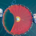
Photo courtesy of Global Fishing Watch