


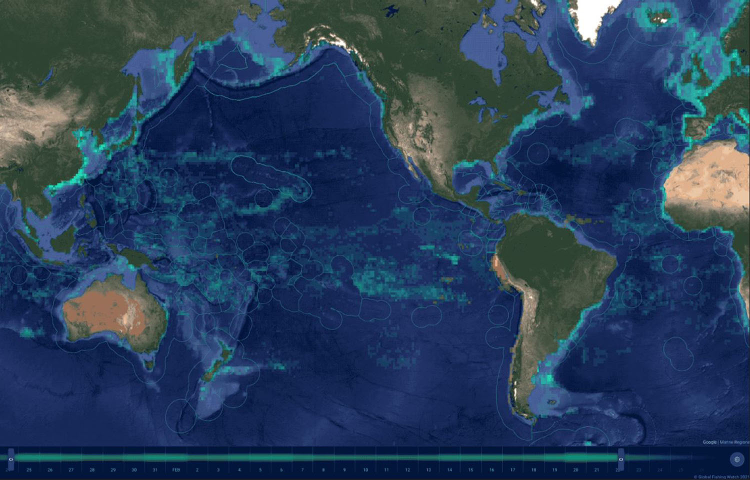
Using a number of inputs, including machine learning, satellite imagery, and automatic identification systems (AIS) data, Global Fishing Watch (GFW) has created – under its Open Ocean Project – the most detailed global map of large vessel traffic and offshore infrastructure that has ever been publicly available.
The study, with its maps and findings published in the British scientific journal Nature, identified and mapped a significant amount of activity that was previously not visible to public monitoring systems, providing a new perspective on previously unmapped industrial use of the ocean.
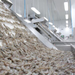
The research found approximately 75 percent of the world’s industrial fishing vessels are not publicly tracked, with much of that activity taking place around Africa and South Asia. By comparison, over 25 percent of transport and energy vessel activity are not included in public tracking systems.
“A new industrial revolution has been emerging in our seas undetected – until now,” Global Fishing Watch Research and Innovation Director David Kroodsma, who is also a co-lead author of the study, said. “On land, we have detailed maps of almost every road and building on the planet. In contrast, growth in our ocean has been largely hidden from public view. This study helps eliminate the blind spots and shed light on the breadth and intensity of human activity at sea.”
The research was conducted by Global Fishing Watch; SkyTruth; the University of Wisconsin-Madison; Duke University; and the University of California, Santa Barbara. It analyzed 2 million gigabytes of satellite imagery from 2017 through 2021 to uncover vessels and offshore infrastructure in coastal waters where over 75 percent of industrial activity is concentrated.
The research was able to identify vessels that failed to broadcast their positions by taking a new approach that synthesized GPS data referencing five years of radar and optical imagery and then used machine learning to identify vessels that were likely engaged in fishing activity.
“Historically, vessel activity has been poorly documented, limiting our understanding of how the world’s largest public resource – the ocean – is being used,” GFW Machine Learning Engineer Fernando Paolo, another of the study’s co-authors, said. “By combining space technology with state-of-the-art machine learning, we mapped undisclosed industrial activity at sea on a scale never done before.”
Requirements for boats to broadcast their position vary greatly based on country, size of vessel, and industry or purpose, making it challenging to get a clear picture of industrial activity based solely on AIS data.
If the majority of fishing vessels and their activity are absent from public monitoring systems, there is not enough accurate data to make management decisions on fisheries and understand impacts on other natural resources and habitat. Due to the absence of public monitoring systems, researchers found a number of instances of non-broadcasting, or “dark,” fishing vessels inside marine protected areas. The research also found concentrations of vessels in countries’ waters that purportedly had little or no vessel activity according to public monitoring systems.
“Publicly available data wrongly suggests that Asia and Europe have similar amounts of fishing within their borders, but our mapping reveals that Asia dominates; for every 10 fishing vessels we found on the water, seven were in Asia, while only one was in Europe," Jennifer Raynor, an assistant professor of natural resource economics at the University of Wisconsin-Madison and another of the study's co-authors, said. “By revealing dark vessels, we have created the most comprehensive public picture of global industrial fishing available.”
The study was also able to show how human activity in the ocean is changing.
Fishing activity decreased globally by about 12 percent, with an 8 percent decline seen in China and a 14 percent drop elsewhere during the pandemic, while transport and energy vessel activity remained close to pre-pandemic levels.
During the five-year study period, offshore energy development increased, with oil and gas structures particularly increasing by 16 percent and wind turbine construction more than doubling. In 2021, wind turbines outnumbered oil platforms globally for the first time, due in part to China’s ninefold increase in offshore wind energy over this period.
“The footprint of the Anthropocene is no longer limited to terra firma,” said co-author Patrick Halpin, a professor of marine geospatial ecology at Duke University. “Having a more complete view of ocean industrialization allows us to see new growth in offshore wind, aquaculture, and mining that is rapidly being added to established industrial fishing, shipping, and oil and gas activities. Our work reveals that the global ocean is a busy, crowded, and complex industrial workspace of the growing blue economy.”
Mapping vessel traffic and, therefore, having a better understanding of how many ships are actually operating in the world's oceans should help provide more accurate estimates of greenhouse gas emissions at sea. More accurate mapping can also inform how wind energy develops in the ocean and track impacts on resources and habitats by industry, according to SkyTruth Geospatial Engineer Christian Thomas.
“Identifying offshore infrastructure is critical for understanding offshore energy development impacts and trends and is crucial data for our work to detect marine pollution events and hold responsible parties to account,” Thomas said.
The research is intended to both fill gaps in data not presently being collected by other entities and to support and complement other public data-collection efforts, Kroodsma said. The data and approach used in this study can help governments, researchers, and civil society identify incidents of illegal activity or encroachment on artisanal fishing grounds or simply better plan for and manage vessel traffic in certain areas, he said.
“Previously, this type of satellite monitoring was only available to those who could pay for it. Now, it is freely available to all nations,” Kroodsma told SeafoodSource. “This study marks the beginning of a new era in ocean management and transparency.”
Greenpeace USA Oceans Campaigns Director John Hocevar said that along with the benefits this research offers the industry and governments, environmentalists also see this move as an important step toward better conservation of ocean resources.
“This study makes it crystal clear just how extensive humans’ impact on the ocean has become,” Hocevar said. “Healthy ocean ecosystems help regulate the climate, protect us from storms, and provide food and livelihoods for billions of people. Quite simply, we need the ocean to breathe; half of our oxygen is provided by the ocean. We all feel the impacts of an ocean that has been thrown out of balance by human activity, and it will only get worse unless we act quickly.”
Global Fishing Watch’s Open Ocean Project was an awardee of The Audacious Project, which along with Bloomberg Philanthropies, National Geographic Pristine Seas, and Oceankind, provided support for the research.
Image courtesy of Global Fishing Watch