


Global Fishing Watch (GFW) is an international non-profit organization founded in 2015 through a collaboration between Oceana, SkyTruth and Google. The group uses satellite technology to track fishing vessels around the world and housing tracking data on its website, where it can be downloaded in near real-time, for free. A GFW study published in February tracked more than 70,000 industrial fishing vessels and analyzed the global footprint of the global fishing industry; this study was critiqued by fisheries scientist and University of Washington researcher Ray Hilborn. GFW’s CEO Tony Long and research director David Kroodsma also published have since published their takes on the study, and in addition, GFW submitted a formal response to SeafoodSource’s coverage of Hilborn’s analysis, which is published in full below.
Global Fishing Watch welcomes Dr. Ray Hilborn’s recent statement in Seafood Source expressing his desire to work together to strengthen our collective insights into commercial fishing activity.
Furthering innovation and collaboration with the scientific community is at the heart of Global Fishing Watch’s mission to advance responsible stewardship of our oceans through increased transparency. Our Research Partners program, an interdisciplinary collaboration with some of the world’s leading marine science institutes, strives to improve fisheries management and science through the sharing of data, new research and cooperation.
Our recent study published in Science was produced with partners at the University of California, University of Santa Barbara, National Geographic Society’s Pristine Seas project, SkyTruth, Dalhousie University, Stanford University, and Google. This research has produced the first-ever dataset of global fishing activities, as captured by satellites using automatic identification system (AIS) positions. Global Fishing Watch’s algorithm processed 22 billion AIS messages to identify more than 70,000 commercial fishing vessels, the sizes of and engine powers of these vessels, what type of fishing they engaged in, and where and when they fished down to the hour and kilometer.
The study and associated maps also depict global fishing activity with an unprecedented resolution - the fishing effort footprint is two to three orders of magnitude higher in spatial and temporal resolution than previous datasets - and reveals that industrial fishing covers more than 55 percent of the ocean’s surface – over four times the area covered by agriculture. This new high-definition global view of fishing would not have been possible without recent advances in computing power, an increase of satellites in orbit, and improved machine learning algorithms.
Importantly, by making all of the data in this study public and freely available, we aim to increase transparency in the commercial fishing industry and improve opportunities for sustainable management and informed decision making. We have also grown the data available within our transparency platform, including adding more AIS data, and through our government and research partners, including vessel monitoring system (VMS) and Visible Infrared Imaging Radiometer Suite (VIIRS) data.
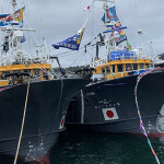
Dr. Hilborn says that vessels monitored for the study were largely tuna boats over 100 feet in length. Technically, these tuna boats are only a fraction of the 70,000 vessels monitored in our study. By far, the vast majority of vessels we observe are Chinese vessels operating in Chinese waters.
For the study, we also only track vessels that have AIS devices, and the fraction of fishing vessels with AIS varies considerably between regions of the ocean. In some regions, such as in Europe, almost all sizeable fishing vessels broadcast their locations. Similarly, in the high seas, we can capture most of the fishing activity, as a high fraction of high seas fishing vessels carry AIS. By contrast, in many developing countries, only a small number do. This fact makes our dataset incomplete, but it is still far more comprehensive than previous global datasets of fishing effort.
Dr. Hilborn also claims that the dataset overestimates the proportion of the seabed that is affected by trawling. There is a body of science around how trawling directly affects the seabed, and our paper did not address that body of work. For trawling, it is common to talk about the area of the ocean floor that vessels drag their trawls. This area estimate, which is very fine scale, will ultimately give a much smaller area than our generalized estimate for trawling specifically. Our paper was looking at a way to estimate the extent across many gear types, and also compare with previous datasets of fishing effort.
One of the most interesting findings in our paper is that the ocean is actually much less fished than the estimates made in previous studies. Existing datasets had estimated catch in 95% of the area of the ocean. We found, instead, that vast areas of the ocean, such as the Southern Ocean and northern Pacific, are not fished. As we note in the conclusion to our paper, these areas may offer low cost opportunities for conservation that will not affect industry.
We value Dr. Hilborn’s review and are encouraged by our recent contact with him. We have shared our data with his research group and hope this will lead to improving our dataset of fishing effort and we look forward to the results.