
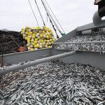



The International Council for the Exploration of the Sea (ICES) has launched an interactive map on the status of fish stocks in the Northeast Atlantic.
The map displays advice for each fish stock within the various ICES ecoregions, and enables users via hyperlinks to gain access to more in-depth information on each stock.
ICES said the map is an easy-to-read digest of the official ICES advice and aims to reach a broader audience by describing the different fisheries in the Northeast Atlantic and the fish stocks that support them.
The map is available for 194 fish stocks, including those in the Barents Sea, Norwegian Sea, Baltic Sea, the Bay of Biscay and Iberian waters, the Celtic Sea, the North Sea, around Iceland, around the Faroes and East of Greenland.
In the future, ICES plans to supplement the information on the map with overviews of marine ecosystems. The overviews will feature descriptions of the ecoregions and provide brief accounts the state of their marine ecosystems.
