



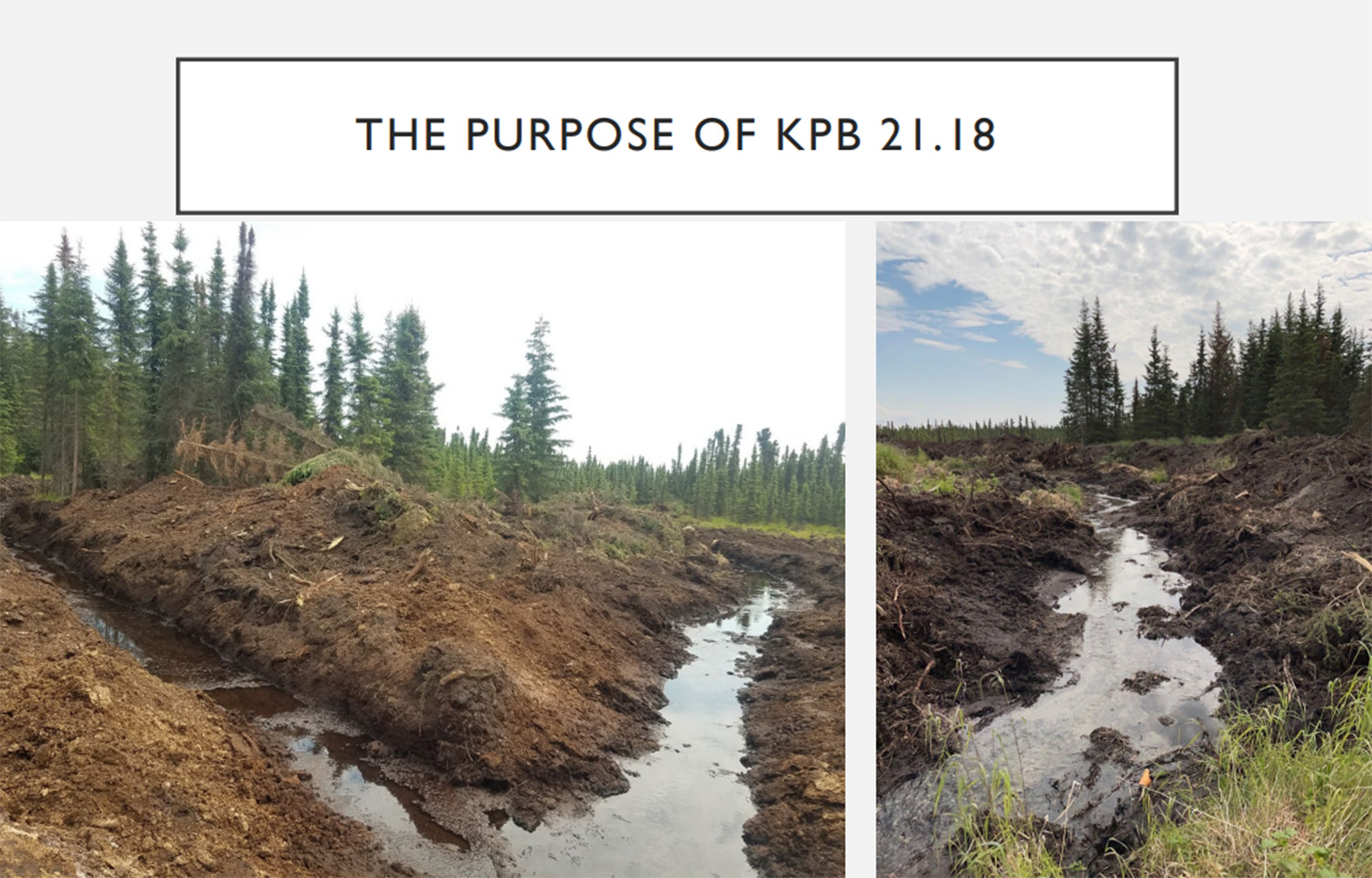
A landowner bulldozing a section of creek in Alaska has highlighted how the intricacies of zoning and permitting can cause negative consequences for the state’s salmon runs.
A property owner "used heavy equipment to straightened a salmon-bearing stream near Soldotna Creek," according to Alaska local news outlet Homer News, and that has resulted in the tributary nearly drying up, cutting of access for salmon. At a 26 October, 2026 Kenai Peninsula Borough Planning Commission meeting, Donald E. Gilman River Center Manager Samantha Lopez said the incident highlights how the intricacies of zoning and permitting projects in the area can have a direct impact on salmon moving through the Kenai River and Soldotna Creek in Alaska.
According to Lopez, the area that was bulldozed is managed by the Alaska Department of Fish & Game (ADF&G), but the creek in question drains into the greater Kenai Peninsula. She said different management teams and response efforts can affect projects like the aforementioned stream when issues caused by landowners arise.
"This is the reality of what happens if the Borough is not adopting streams to regulate," Lopez said. "This is a stream that we currently don't regulate, but Fish and Game regulates it, and there is salmon in it and it is a direct contributor to Soldotna Creek, which is kind of a crown jewel in Soldotna for salmon populations."
Lopez explained that permits through the Borough must be obtained for bank restoration, general construction, and building of infrastructure, but are not required for vegetation maintenance, maintenance of prior existing uses, removing derelict structures, or flagpoles. But, instances where an environmental engineer is not consulted and permits are not obtained can lead to small instances of habitat destruction that lead to wider scale environmental issues for fisheries.
The out of state property owner's decision to change the course of the stream has subsequently caused a multi-year issue involving the Environmental Protection Agency (EPA), ADF&G, and multiple years of corrective work to restore that stream's ability to flow salmon into greater bodies of water.
"That one, he bought property, was from out of state, we had no regulatory authority on it, and we had to step back and let Fish and Game handle it," Lopez said. "I believe it took years, the EPA got involved, and it's still a straight shot, there's no meanders left in it. Fish and Game went in and installed some things to help the hydrology in it so that it could be more habitat friendly but it's still plowed through and looks pretty close to that still which is unfortunate. It was a really, really large plot of land and somebody had a free weekend and a bulldozer."
Lopez explained during her presentation that the River Center is a multi-agency permitting and outreach center that manages planning, zoning, floodplain management, habitat management, and ADF&G habitats. The organization monitors 980 total waterbodies, 875 streams and rivers, and 105 lakes dating back to 1996. The center works on habitat protection districts, which are defined as "all lands within 50 horizontal feet of anadromous waterbodies," Lopez said.
Issues like the landowner bulldozing land causing issues this are more prevalent in years of low salmon runs. In 2026, the Kenai River late-run sockeye finished at the end of August at a cumulative 1.1 million sockeye salmon, compared to 4.3 million in 2025 and 1.9 million in 2024. The 2026 run is the lowest in 5 years, with the second lowest being the 1.5 million run in 2022. For Kenai River chinook salmon early runs, the 2026 season ended in late June with a cumulative 1,499 Chinook salmon. In 2025, the cumulative total was 2,541, and the 2024 cumulative total was 1,365.
Additionally, Lopez said that streams are not adopted at a fast pace into the Borough's management system, and the department constantly works with ADF&G to monitor areas for high fish counting traffic, as well as possibly environmental crises. While the Borough may not adopt every waterway, Lopez said the management team uses evidence, field surveys, photographs, and records to document areas and collects information to be presented at the borough's public hearing process – which can take years.
"It's not just as simple as fish and game flew over in a plane once in 1977 and they said there was fish so now we decided there's fish so we're going to regulate and zone property for it," Lopez said. "Fish and Game makes that call, they say, 'hey, we think there's fish here,' we say 'great', so the next step is we at the Borough, we're going to look at that data."
