


Earlier this month, the National Oceanic and Atmospheric Administration (NOAA) held a virtual meeting of the Hydrographic Services Review Panel (HSRP) to discuss progress made in the offshore mapping of Alaska, among other topics.
The HSRP is a federal advisory committee comprised of stakeholders who assists in advising NOAA on navigation-related products, data, and services.
Much of the latest meeting’s discussion related to the presidential memorandum issued by President Donald Trump, which directed federal agencies to “develop a national strategy to map the United States’ exclusive economic zone and a strategy to map the Alaskan coastline to advance our understanding of our oceans and coastlines and to promote efficient permitting related to ocean exploration activities.”
The memorandum was released in draft format in November 2019, and is currently at the White House for review. According to Nicole LeBoeuf, acting administrator of the National Ocean Service, the final version is expected in late spring or early summer.
“Having a presidential memorandum on anything ocean is very exciting,” LeBoeuf said.
The presidential memorandum noted that “completed mapping is especially lacking for Alaska and for the Alaskan Arctic, which lacks the comprehensive shoreline and nearshore maps available for much of the rest of the nation.” To remedy this, the memorandum ordered a completion of the Alaska coastal mapping strategy.
Rear Admiral Shepard Smith, who serves as the director of the Office of Coast Survey at NOAA’s National Ocean Service, said that he hoped the presidential memorandum could provide momentum on getting the Ocean and Coastal Mapping Integration (OCMI) Act reauthorized.
The OCMI Act provided scientific funding and called for a “comprehensive federal ocean and coastal mapping plan for the Great Lakes and coastal state waters, the territorial sea, the exclusive economic zone, and the continental shelf of the United States that enhances ecosystem approaches in decision-making for conservation and management of marine resources and habitats, establishes research and mapping priorities, supports the siting of research and other platforms, and advances ocean and coastal science.”
Although the act has not been reauthorized since 2009, and technically expired in 2015, NOAA still follows the directive.
NOAA’s goals laid out in its strategy to map the Coast of Alaska are to: “Build on existing mapping partnerships to meet Alaska’s coastal mapping needs, expand coastal data collection to deliver the priority geospatial products stakeholders require, leverage innovation in mapping technology development, and conduct strategic communications to promote widespread stakeholder engagement.”
The mapping will be led by NOAA, in coordination with the state of Alaska and the Alaska Mapping Executive Committee, which is comprised of a group of 15 federal and state organizations.
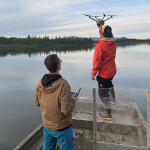
Smith called the mapping project “critical for forecasting climate change,” and noted that the goals set could not be achieved using current technology. Improvements in SONAR and LIDAR mapping as well as in unmanned systems and artificial intelligence would be needed, Smith said.
Smith acknowledged that a large portion of the mapping project would involve “getting data out of shoeboxes into the public domain,” which suggests that more research has been done than is readily available.
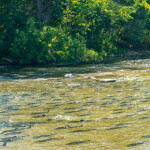
As it stands, 72 percent of Alaskan waters are still unmapped as of 2019. For comparison, as of last year, 24 percent of waters in the Pacific region (Washington state, Oregon, and California) were unmapped, 43 percent of the Atlantic region and the Gulf of Mexico waters were unmapped, and 95 percent of Great Lakes waters were unmapped. Altogether, some 54 percent of total waters in the United States were unmapped as of last year, according to a NOAA report released in March 2020.
Progress is being made, however, LeBoeuf said – between 2017 and 2019, the percentage of unmapped United States waters dropped from 59 percent to the 54 percent, where it stands today. The NOAA report is due to be updated annually to track progress moving forward.
The meeting was meant to have been held in Oahu, Hawaii, but was canceled and held online via video due to the coronavirus concerns.
Photo courtesy of AridOcean/Shutterstock