India’s Central Marine Fisheries Research Institute (CMFRI) has launched an online database using the geographic information system (GIS) to assist local authorities in the southern state of Kerala in their management of the fisheries sector during the COVID-19 pandemic, the institute said in a statement 6 May.
The launch took place as India's government has extended a nationwide lockdown the second time to try to contain the spread of the outbreak in the world’s second-most populous country.
The GIS-based database will provide visualization of all 156 fish landing centers in Kerala, divided in three categories presented in color groups corresponding to their geographical proximity to coronavirus hotspots, as identified by Indian governmental authorities.
In the first category, precautionary measures must be taken for fish-landing centers located within three kilometers from a hotspot. The second category will involve the centers located between three and five kilometers from a hotspot, and centers at a distance of between five to 10 kilometers from the hotspot will fall under the third category.
The GIS database, which is accessible via CMFRI’s website, will be updated regularly, making it possible for anyone to check online the category of a particular fish-landing center in Kerala, CMFRI Director A. Gopalakrishnan said.
“The initiative will greatly help authorities and policy makers to monitor the daily activities and take steps for regulatory or safety measures in marine fisheries sector in the backdrop of the COVID-19. The database will become a useful tool to implement safety measures for each landing centers according to their category,” Gopalakrishnan said.
The institute is working to apply the database for fish landing centers in other states in India, he added.
As of 7 May, India had nearly 53,000 confirmed cases of the COVID-19, with almost 1,800 deaths, according to The Economic Times.
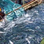
Photo courtesy of CMFRI


