



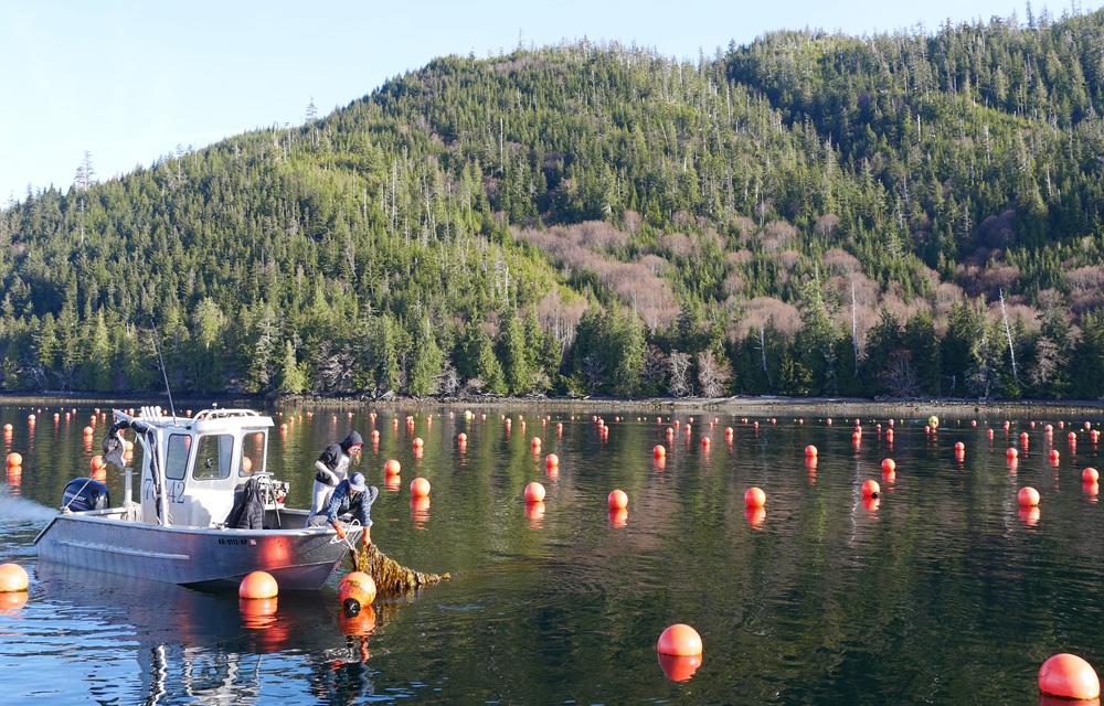
NOAA Fisheries has identified 77 locations in the Gulf of Alaska that could be suitable for aquaculture operations, following up on an order issued by U.S. President Donald Trump in 2020.
“Alaska has more coastline than the rest of the nation combined, and we should be using that resource to its full potential,” Alaska Governor Mike Dunleavy said in a release. “This atlas helps identify where aquaculture makes sense in our state waters. It will support creating new job opportunities, strengthen food security for Alaskans, and add to Alaska’s already tremendous seafood industry.”
NOAA Fisheries has been working on identifying aquaculture opportunity areas (AOA) since Trump’s first term, when he issued an executive order charging the agency with determining which areas off the U.S. coast would be conducive to commercial shellfish and seaweed aquaculture operations.
“More effective permitting related to offshore aquaculture and additional streamlining of fishery regulations have the potential to revolutionize American seafood production, enhance rural prosperity, and improve the quality of American lives,” Trump said in the order, which called on the federal government to remove “outdated and unnecessarily burdensome regulations.”
In the intervening years, NOAA Fisheries has worked to locate appropriate AOAs in the Gulf of Mexico – currently referred to as the Gulf of America by the U.S. government – off the coast of California, and in the Gulf of Alaska. In September 2025, the government announced that it had identified 10 AOAs off the coast of Southern California and another three off the coast of Texas. The sites ranged between 500 to 2,000 acres, covering 21,000 acres of federal waters in total.
Now, NOAA Fisheries has published an atlas showing 77 locations in state waters in the Gulf of Alaska that could be AOAs spread over 10 study areas. In total, the locations cover more than 13,000 acres, with individual sites ranging from 50 to 2,000 acres. Unlike the previous AOA atlases, the Gulf of Alaska efforts included state waters, and 11 intertidal AOA options were identified, covering a total of 893 acres. The remaining 66 options were in subtidal locations.
According to the agency, the sites were reviewed by “hundreds” of organizations “through an extensive peer-review process.”
“NCCOS developed each atlas using more than 85 data layers accounting for key considerations that contribute to the triple bottom line of environmentally, economically, and socially responsible coastal and offshore development,” the National Centers for Coastal Ocean Science (NCCOS) said in a release.
The sites identified in the atlas are technically not AOAs, NCCOS noted, but will be used to inform the future designation of AOAs in the Gulf of Alaska.
“The decision to identify an AOA will only be made after completion of the National Environmental Policy Act (NEPA) Programmatic Environmental Impact Statement, which will assess the impacts of siting aquaculture facilities in potential locations. All proposed aquaculture development must also go through the appropriate permitting process,” NCCOS said in a release.
NOAA Fisheries noted that the sites were selected to minimize conflict with existing commercial, recreational, and subsistence fisheries while utilizing existing infrastructure.
“Americans should have access to safe, healthy, locally produced seafood,” NOAA Administrator Neil Jacobs said in a release. “This atlas is a powerful source of coastal data, maps, and analysis that will inform aquaculture development in the state of Alaska and reduce America's reliance on seafood imports.”
